LiDar and its Applications Part 3 – Micro-Topography


Briefly in the previous article, I brought up a topic or domain that is vital for different LiDar applications. In college, I distinctly remember in some of my physics classes how I would fail to pay attention to certain things or topics because they bored me. This topic actually got my attention and I rarely missed questions on it in exams. The topic we are talking about is topography and in particular micro-topography
Topography is the study of the shape and features of land surfaces. The topography of an area could refer to the surface shapes and features themselves, or a description.
Topography is defined as the study of the shape and features of land surfaces. An area’s topography refers to the features and surface area shapes of the landscape. The topography of land surfaces gives us a description of the environment. Being able to measure these items is vital for various industries.
Topography can be defined as a field of geoscience as well as planetary science. This is due to a focus on local environmental detail. It also includes natural and artificial features for land. This helps when studying things such as the history of a land and predicting the future of its development.
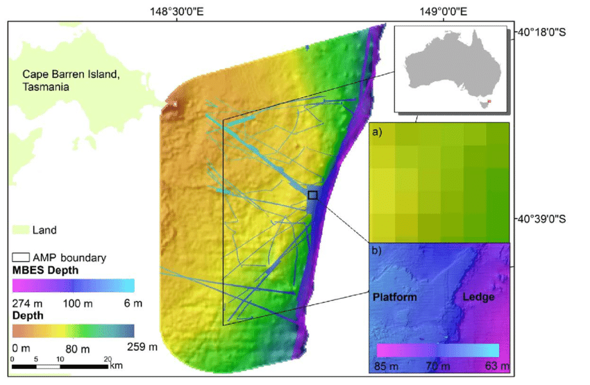
Topography usually involves the recording of three dimensional data from the land we are intrigued by. As we spoke on this recently, this data (DEMs) can be taken through the use of LiDar technology. The technology allows us to have a graphic representation of land on a map. This is done using contour lines, hypsometric tints, and relief shading. Hypsometric tints refer to colors placed between contour lines to indicate elevation levels. Relief shading refers to hill-shading. This shows the shape of a terrain in a realistic fashion. Wed do so by showing how the three-dimensional surface would be illuminated from a point light source.
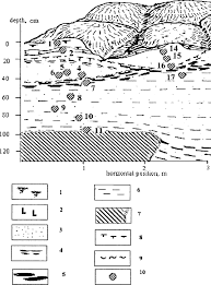
Micro topography, also known as microrelief, specifically refers to the small differences between the elevations in a surface. These are surface features of the earth with small dimensions, commonly less than 15 meters. LiDar scanning does a good general job of recording the differences in micro-elevation. The problem with accuracy usually comes from how precisely we can process the data. Current processing of LiDar data through data providers has most microrelief features generalized in a smooth best-fit approach.These smoothed estimations are limited but still great for recognition and are a good basis to start studying differences in micro structures of land.
With laser scanning, we have previously learned that we use metrology to do our best for accuracy. We are not at a point in society where we can exactly measure items and compare their properties. That point in society is where we stop science. The ability to use this 3D data from LiDar is still useful as it gives us something to compare and analyze further.
Discuss this and other 3D printing topics at 3DPrintBoard.com or share your thoughts below.
Subscribe to Our Email Newsletter
Stay up-to-date on all the latest news from the 3D printing industry and receive information and offers from third party vendors.
Print Services
Upload your 3D Models and get them printed quickly and efficiently.


You May Also Like
How One Artist Is Using 3D Printing to Tell Stories About the Ocean
Artist Kimberly Callas sees something different when she looks at a 3D printer. Where others see a machine for making parts, she sees a way to tell stories about the...
Bambu Lab Wants Home 3D Printing to Feel Less Like a Workshop with PLA Pure
As desktop 3D printers become increasingly common in homes, Bambu Lab is focusing attention on something beyond print speed and hardware features. This week, the company launched a new filament,...
AM Asia Watch: China Exported 2.46 Million 3D Printers in Four Months
China’s consumer 3D printer industry seems to be reaching a new level of global dominance. According to Chinese state media outlet China Global Television Network (CGTN), China exported 2.46 million...
Bambu Launches A2L: What the New Printer Reveals About Its Strategy
Bambu Lab continues its relentless march for 3D printing domination with the launch of the A2L. The 330 × 320 × 325 mm printer will have a nozzle temperature of...