

Follow in the Footsteps of Matt Damon in ‘The Martian’ with NASA’s 3D Mars Trek 2.0

![]() Over the summer NASA launched Mars Trek, an interactive 3D map of the red planet that allowed users to zoom in and out of key areas of the planet’s surface. The interface was similar to Google Earth, though NASA included annotated locations where users could learn more about the Mars landmarks, the science of sending probes to the planet and even follow the paths of the various Martian rovers that have been exploring the planet for years. They also included an amazing feature that allows users with 3D printers to capture any of the three-dimensional features and turn them into 3D printable .obj models.
Over the summer NASA launched Mars Trek, an interactive 3D map of the red planet that allowed users to zoom in and out of key areas of the planet’s surface. The interface was similar to Google Earth, though NASA included annotated locations where users could learn more about the Mars landmarks, the science of sending probes to the planet and even follow the paths of the various Martian rovers that have been exploring the planet for years. They also included an amazing feature that allows users with 3D printers to capture any of the three-dimensional features and turn them into 3D printable .obj models.
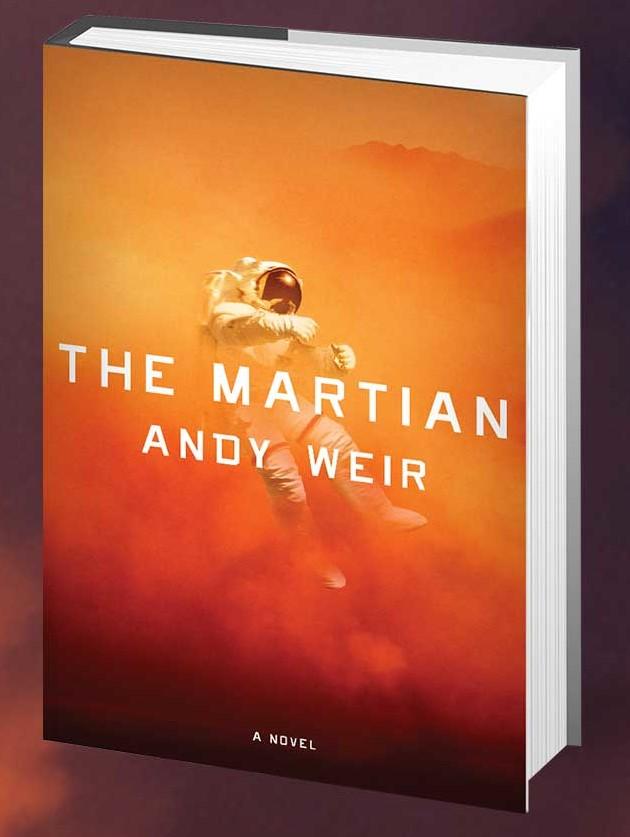
Since the recent success of the hit Matt Damon film The Martian, NASA has been riding a wave of renewed interest in space exploration, and has even officially announced a manned mission to Mars by 2030. They have also launched a highly successful competition to develop new technologies that would make it possible for Mars explorers to 3D print structures and habitats from the raw materials available on the planet. It is probably safe to say that NASA hasn’t had this much interest in their space program in decades and as fans of the remarkably realistic (by Hollywood standards) movie themselves, they are taking full advantage of the interest in the film.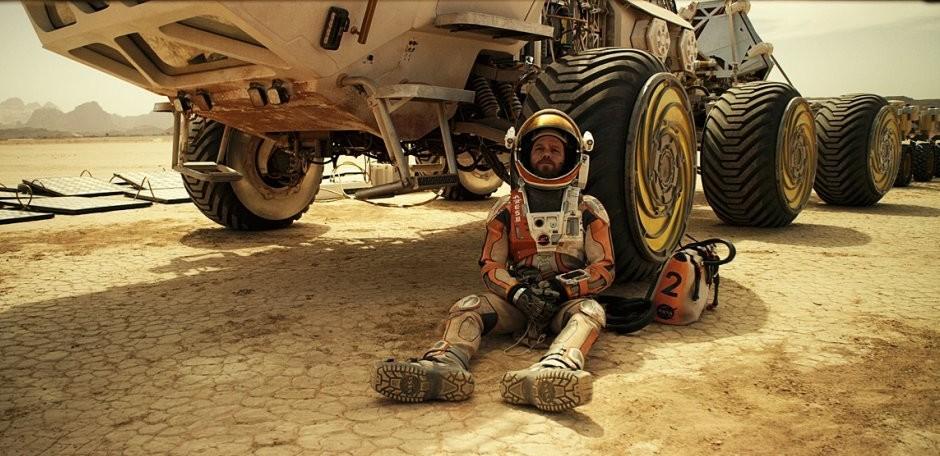
In The Martian, and the novel that it was based on, astronaut Mark Watney (played by Damon) is part of the first manned mission to Mars when he and his crew are struck by an unexpected storm. Watney is presumed dead and left without any means of communication, so while the rest of the crew escapes and begins the lengthy return trip to Earth, he is left to survive on his own. A major part of the film includes Watney making a nearly impossible two thousand mile trip across the surface of the planet in order to make it to the landing spot of the next manned mission.
 The author of the novel, Andy Weir, wanted to make the trip as realistic as possible, so he included real Martian landmarks. He recently provided NASA with the exact coordinates of every location that Watney passed in the novel, in the hopes that they would take images of the trip using the real locations. NASA agreed, and recently released what they are calling Mars Trek 2.0 which charts Watney’s path and allows users to interact with each step of his remarkable journey. As with the original Mars Trek, the updated version includes an interactive map that offers commentary from actual NASA scientists for many of the amazing Martian features that Watney encounters. They even fact check Weir on a few key points where his novel wouldn’t reflect reality, including areas of the trip depicted as flat that would actually be quite rocky and difficult to navigate.
Movie versus reality.
Watney’s journey begins at the ‘Ares 3’ landing site located at the southern Acidalia Planitia, an area that the film depicts as smooth and flat–unfortunately most of the area is covered with large boulders and rocky outcrops several meters tall. The Ares 4 landing site, which will eventually become the location of his rescue mission, is the Schiaparelli crater in an area known as the Arabia Terra. In the film and novel it is describes as being rockier and harder to navigate than Acidalia–however, according to NASA, it is exactly the opposite and in reality much smoother and quite flat.
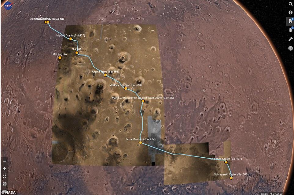 The interactive map has both 2D and 3D functionality and a complete set of tools and bookmarks that make exploration of Watney’s path incredibly immersive. There are several areas bookmarked along his path that play key parts in the film full of data and facts directly from NASA scientists. Users can also switch to 3D mode and automatically traverse the surface at various speeds, as well as stop at any point throughout the journey and pan across the 3D rendered terrain.
And the entire path taken in The Martian is available as a massive 3D printable file that contains realistic textures provided by the Viking MDIM2.1 Colorized Global Mosaic 232m. The model can be printed as a whole, or imported into 3D model editing programs and divided up into sections.
Let us know your thoughts on Nasa’s new Mars Trek 2.0 app here. Here is some video of the interactive map and the 3D journey feature in action:
Subscribe to Our Email Newsletter
Stay up-to-date on all the latest news from the 3D printing industry and receive information and offers from third party vendors.
Print Services
Upload your 3D Models and get them printed quickly and efficiently.


You May Also Like
Where the Money Is Going: The New Infrastructure Landscape
This is Part 1 of a two-part PRO series examining where infrastructure investment is flowing and how those trends are reshaping manufacturing, energy, logistics, and additive manufacturing. Part 2, by...
3D Printing & Drone Dominance: Speed, Performance, and Derisking the Supply Chain
A shift is underway in drone manufacturing. Government programs like the U.S. Department of War’s Drone Dominance, a $1.1 billion effort to deliver low-cost, one-way attack (OWA) sUAS at scale,...
3D Printing Financials: Stratasys Bets on Defense and Drones as Printer Sales Slow
Stratasys (Nasdaq: SSYS) started 2026 with lower revenue and a larger loss as customers continued to slow down spending on new 3D printers. Still, the company pointed to stable recurring...
INDOPACOM Advanced Manufacturing Team Saves Thousands Per Week at Joint Exercise in the Philippines
In the summer of 2025, the US Indo-Pacific Command (INDOPACOM) opened a new advanced manufacturing facility at Schofield Barracks, the Hawaiian home of the US Army’s 25th Infantry Division. INDOPACOM...