Finally, in early 2014, the eight-member team picked up the pace. Development of the 2D basemap, which became a direct reference for the eventual 3D printed model, began in earnest. The basemap was used to isolate the city of Oslo into sectors. Existing structures, areas where projects were underway, and future development projects were included in the 3D model.
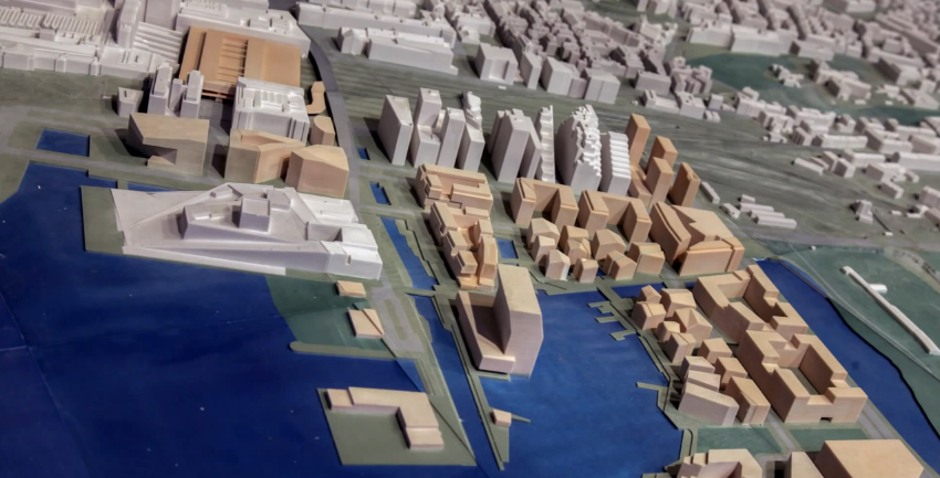
The 3D printed model of Oslo, which covers an area of 34.8 km2 within the city’s central area, is divided into 360 blocks of around A3 DIN size (standard sizing for drawings, diagrams, and large tables). Overall, the 3D printed model measures 7.6m x 4.5m. The scale is 1:1,000.
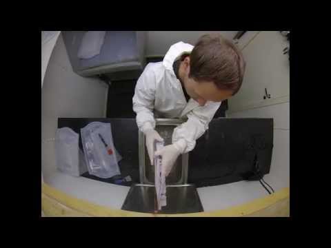
The 3D model was printed using two 3D Systems ZPrinter 650 3D printers. It was assembled on a wooden platform. Every block is detachable; that is, you can pull it out of the larger model for closer examination. This segmented approach makes it much easier and clearly less expensive to update the model when necessary. Each of the blocks or segments is comprised of different layers of data compiled in ZEdit Pro by Portland, Oregon-based Peak Solutions.
The main portions of each block consist of a terrain model, 2D cartographic information, and 3D buildings. The terrain models are based on LIDAR (Light Detection and Ranging) data, remote sensing used to examine the surface of the Earth, which is adjusted to smooth out terrain and eliminate height or gap issues that might otherwise occur in the 3D printed model.
One of the major benefits of using the ZPrinter 650 is the ability to print in full color. Designers used XFactor (First Interactive AS) and GISLINE (Norkart AS) to convert the 3D polylines. Autodesk’s 3D Studio Max was used to create the buildings within the future development areas; to do this, designers consulted urban plans made available by Oslo’s Department of Urban Planning.
Putting it all together once the necessary data was aggregated was no small feat. The team used ZEdit Pro, which enables users of 3D mechanical CAD software to verify and ensure that geometric 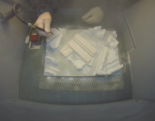
When the 3D printing got underway, six members of the team rotated between building and printing blocks, which gave them all task and experience variety. Two of the other project members worked in support capacity and performed tasks like laser cutting and data conversion.
The largest exclusively 3D printed model in the country, it is displayed in the lobby of the agency where it serves as an interactive information platform. Moreover, it is an invaluable aid to urban planning.
“One of the team’s future goals,” said Oslo’s Agency for Planning and Building Services, “is to make smaller 3D models that will not be permanent, but mobile and can be used in different public space such as libraries, or in events such as architectural exhibitions.”
Let us know what you think in the 3D Printed Oslo forum thread over at 3DPB.com. Check out the video below of the process.