
![]()

Morgan uses Strava, a website and mobile app that’s used to track one’s athletic activity through GPS, but says that you can also use Garmin to track GPS for a 3D printed route model.
The PrintMyRoute website asks, “Have you taken part in an epic bike ride? Or run up and down an enormous mountain (you crazy person!) Maybe you’ve raced the entire length of an island, or even a country? Why not get a tangible reminder of your achievement for posterity?”

“After I’d made a few good prints, I spoke to a few members of my local cycling club who all liked the concept,” Morgan explained to BikeBiz. “Our 3D printed routes initially spread by word of mouth, and I decided to start the website last month and at the same time began promoting on social media. Feedback so far has been great, people seem genuinely interested in the product.”

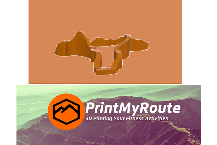
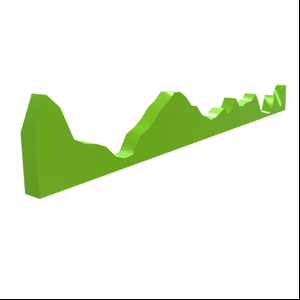
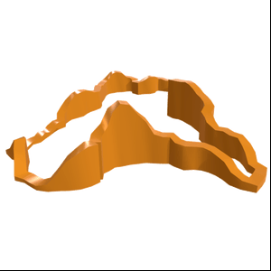
Morgan said, “We have three main variations of 3D prints to choose from; the Linear Elevation Profile is a side on view of the route showing you the lumpy ascents and descents over the course of route – it’s a 3D print of a 2D profile. Then we have the popular Map Profile, which is a miniature scale map of the route – essentially adding an extra dimension to the linear profile, and we’re also offering Pre-Made routes, so those are routes that won’t necessarily have GPS data available – e.g. if someone did the Alpe d’Huez but didn’t record it with a GPS device. We’ve also added the climb to Everest base camp and will soon be adding the Nuerburgring/Nordschleife and other popular circuits to this category.”
PrintMyRoute will also be introducing a new option soon – a 3D printed route model mounted in a black or white 8″ x 8″ box frame, which can be printed in a variety of colors and include a plaque on the front, where you can name the route and date.

Morgan says that the biggest route the startup has printed so far was for a nearly 2,000 km route, but that shorter routes, like the Alpe d’Huez with 21 hairpin turns and an average gradient of above 8%, can look just as impressive. The renderings that PrintMyRoute creates are very accurate, but the site does encourage users to make sure that the GPS routes they choose contain elevation data, so a linear profile of the route isn’t just a flat line.
The goal is for PrintMyRoute to become an established, recognizable brand for athletes. The affordable PrintMyRoute products range in price from just £9.99 for a Linear Elevation to £24.99 for the 3D printed route model in a box frame, so I don’t think that will be an issue. Maybe I’ll see if my husband would like one of our fateful run all those years ago…or perhaps he’d like a 3D printed route that doesn’t conjure memories of his wife about to pass out.
Share your thoughts in the 3D Printed Routes forum at 3DPB.com.
[Sources: BikeBiz, PrintMyRoute / Images: PrintMyRoute]