Throughout history, from painters like Monet to photographers like Ansel Adams, Clyde Butcher, and more, artists have been so inspired by nature that they were moved to create their own expressions and translations of its attributes — meant to be shared with others. Cartography and topography provide an understanding of our landscape, local region, and attitude toward an area all rolled into one.
“I’m pretty sure you could drive around it twice in one day if you tried,” said Pavey, who was an Oahu resident in the past.
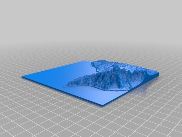
As a technical artist in the video games industry who takes joy also in producing tangible, ‘real’ creations, Pavey set to work to create another 3D printed map. We recently reported on his 3D printed map of the San Francisco Bay, an artistic labor of love depicting his home area. The project was made possible after Pavey discovered Thatcher Chamberlin’s software program, Terrain2STL, which created the printable mesh and took on “the heavy lifting of the map geometry creation.”
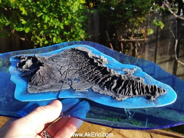
Using Terrain2STL to identify Oahu in Google Maps, Pavey was able to receive the .stl file to continue on to slicing, using MakerBot Desktop. For the 3D printing, he used a MakerBot Replicator. After working on a number of different issues with his San Francisco map such as improving density and highlighting the shoreline, as well as putting finishing touches and accents on the 3D print with epoxy and paint, Pavey was at the ready for getting creative and adding any necessary ‘tweaks’ specifically required for the Oahu 3D print.
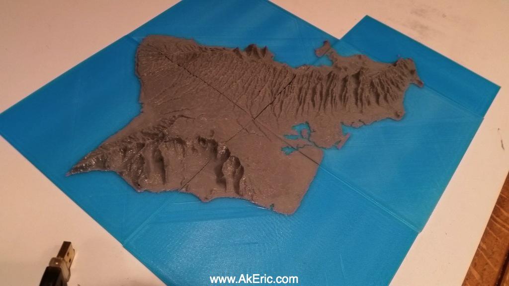
Again, due to difficulty in translating geography from Google Maps, there were the expected ‘holes’ in the .stl file, which Pavey pointed out were a result of the cliffs in Oahu. While he used Meshlab to deal with that issue successfully in his last project, that just wasn’t sufficient in the Oahu print. Pavey was able to use Microsoft’s Model Repair Service to clean up the files easily and successfully, and has shared them on Thingiverse, for all to download, and use for their own inspiration in creating 3D printed topography. 3D printing took around three hours or less.
So while some prefer to paint a watercolor or mail a postcard, Pavey goes the extra mile with 3D printing in showing you his most beloved landscapes, as well as some of America’s most popular vacation and recreational venues. We look forward to reporting on his next 3D printed ‘scape. Have you tried 3D printing any topographical maps or something similar? Tell us about it in the Oahu in 3D Print forum over at 3DPB.com.