![]()
Meteorologists catch their share of flak, despite the substantial amount of technology they have helping them put out predictions. Now, however, as with many other processes, 3D and 4D technology may be about to transform the world of those telling the story of the weather of each day.
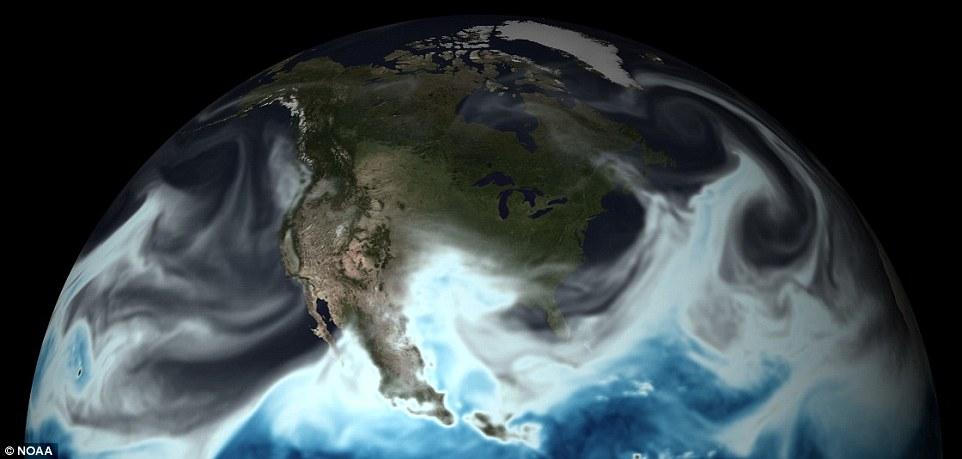
Backed by the National Oceanic and Atmospheric Administration (with whom you are probably very familiar if you live in areas prone to hurricanes), this new model for forecasting should prove to be much more accurate, and is part of a big new upgrade. But how will these new digital models enter the fourth dimension, exactly? Beginning on a 3D spatial grid, showing what’s going to happen in the future is where 4D comes about, morphing into next week. You’ve heard of the radar in motion? This is like maps in motion, with the fourth dimension indicating what’s happening tomorrow or next weekend.
Louis Uccellini, Ph.D., director of NOAA’s National Weather Service
“America’s needs for weather, climate, and water information and prediction are growing, and we’re advancing our capabilities to meet current and future demand,” said Louis Uccellini, Ph.D., director of NOAA’s National Weather Service.

Last year, improvements were made to their Global Forecast System (GFS), which according to the weather agency was able to double resolution and allow for much better forecasts. This new system is better able to respond to what’s happening on earth, and what will be happening in the future, meaning too that forecasters can better inform the public when crucial warnings are required. The GFS runs four times a day and reports are given up to 16 days in advance. It also allows for hourly forecasting of five days at a time.
Accurate predictions within small amounts of time really change the scope of forecasting, obviously, and are important for watching and tracking storms and giving emergency managers around the country information to work with. Let’s not forget as well that this is primo information when it comes to traffic, too, allowing viewers to plan their commutes accordingly when flooding or icy roads prevail on those early mornings.
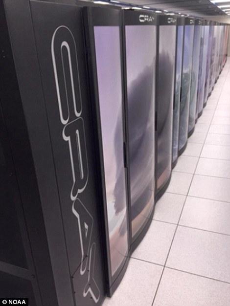
The NOAA supercomputer
With the new 4D models and upgrades, GFS will be better equipped to give satellite observations from the Joint Polar Satellite System (JPSS) and GOES-R. As the GOES-R (Geostationary Operational Environmental Satellite – R Series) satellite launches later this year, those predicting the weather will find themselves being able to look at updates every 30 seconds should that be necessary. Observations will be made in cloudy or clear conditions, and can be made from aircraft for better results.
“The GFS is the foundation for all of our weather and climate models, so today’s upgrade will add skill across all NOAA’s forecast mission areas, including hurricanes and other high-impact weather,”said Uccellini.
The powerful supercomputers will be accentuated with numerous upgrades and improvements through this spring and summer. You may be rather stunned to know that they are, nonstop, processing 2.8 quadrillion mathematical calculations per second around the clock. Not only that, they are each said to be as large as a school bus. Many of us probably assumed that computers of that size were a thing of the past, but not so, as these particular supercomputers are indeed responsible for collecting the information that may save a life as a snowstorm or hurricane approaches. They collect numerical data regarding:
- Temperature
- Air pressure
- Moisture
- Wind speed
- Water levels
All of the weather and climate information, as well as GFS models from NOAA, are free, as they continue on in their mission to understand Earth and all its complexities—especially as it results in numerous weather situations that may affect us at any moment. Have you seen any improvement in forecasts overall? Discuss further in the NOAA 4D Forecasting forum over at 3DPB.com.
[Source: Daily Mail]