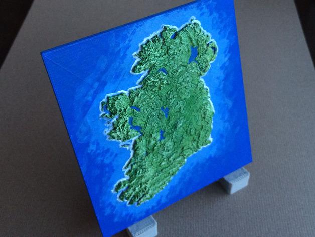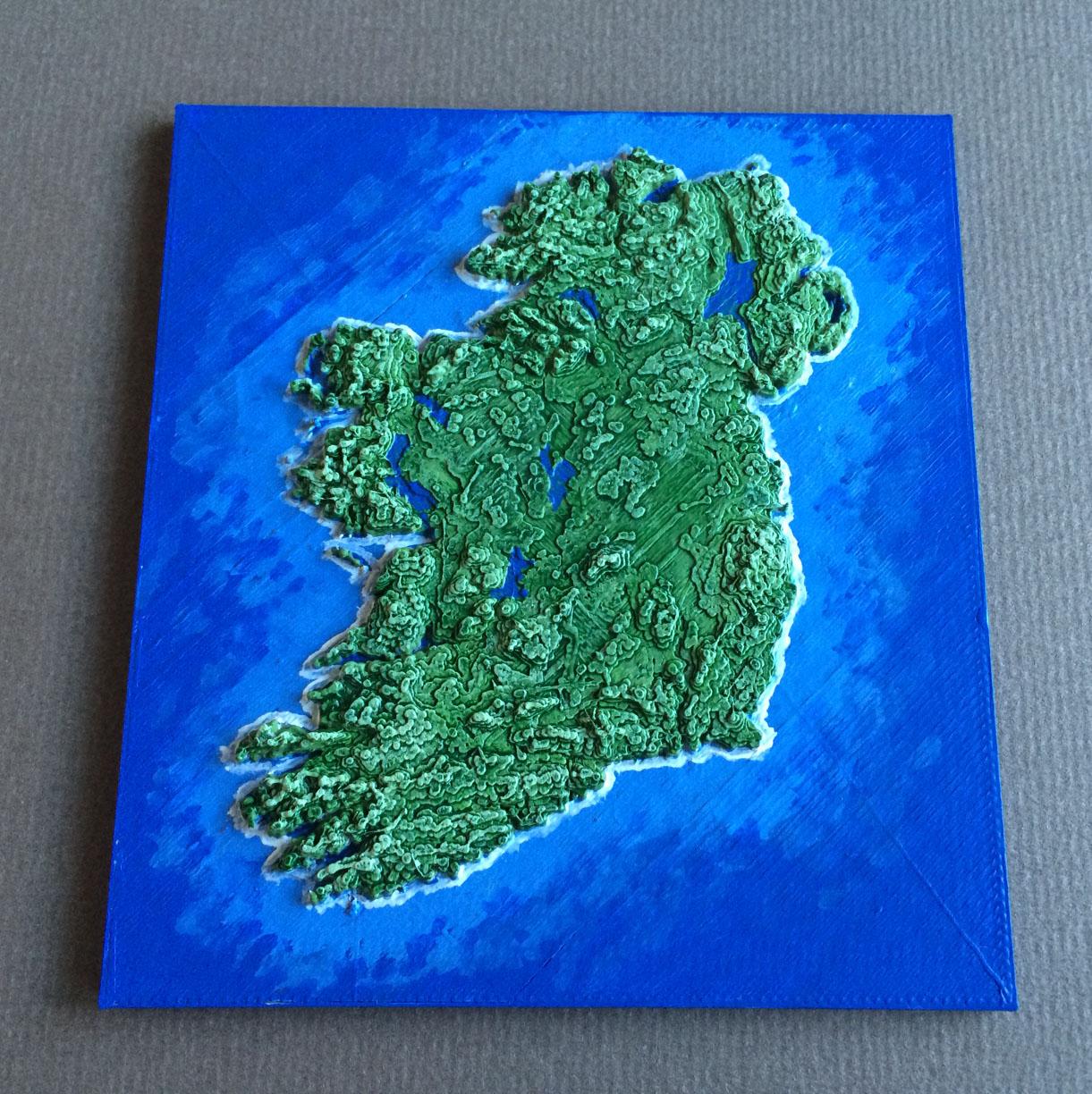
Conor O’Kane (“Cokane”) seems like a bit of a Renaissance man when it comes to the interests he lists on his blog: “game development, graphics, music and shmups” — but he forgot to include 3D printing on the list as well. After all, a perusal of his blog reveals that he is quite adept at using a 3D printer, and we see these skills in one of his most recent projects as well. This project is quite dear to his heart, as O’Kane is Irish. Having moved to Melbourne, Australia in 2002, O’Kane misses home enough to engage the entire island of Ireland as a 3D printed map project.

And, of course, this topographic data includes lovely Ireland. O’Kane has taken the data and transformed it into a 3D printable map that he presented to his parents. This detailed map, which is also available for download on Thingiverse, was made using a Cocoon Create 3D printer, with no rafts or supports. It was 3D printed at 0.2mm resolution and 20% infill (O’Kane recommends it be printed with “three top layers to ensure the upper surfaces are flat”). This map has already been viewed 1,614 times and its STL file has been downloaded 387 times.
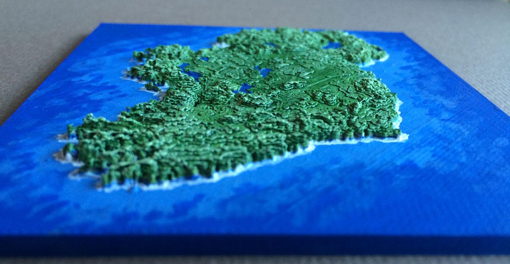
One possible reason this map is such a popular item is because the topographical data now available to the public is much more detailed than what was made previously available. In late 2015, the highest resolution data became available to the public. Previously, SRTM data for regions outside the United States were sampled for public release at 90 meters (295 feet). The new data have been released with about 30 meters (98 feet), sampling that reveals the full resolution of the original measurements. What this all translates into is that never before have we had such full and wide-ranging access to detailed global topographical data — allowing for map projects like the one that we see with O’Kane’s Ireland.
Several other people have posted their own 3D printed versions of the Ireland map, and they all look slightly different, but retain the basic design of O’Kane’s original map. I am sure we will be seeing more 3D printed maps using the newly available SRTM data, as O’Kane’s idea can be theoretically applied to almost everywhere on the planet Earth now! (Though O’Kane has also enjoyed using NASA data to 3D print maps of the moon and Mars!) We are seeing more and more 3D printed maps — and the data options are growing better all the time! What do you think of Ireland? Discuss in the 3D Printed Ireland Map forum over at 3DPB.com.